
Review the Route 40 Design Updates
Review the final designs in the Fremont neighborhood
Overview of improvements in Fremont
The Fremont neighborhood is known as the “Center of the Universe” due to its lively culture, consisting of small businesses, a thriving art scene, the Fremont Sunday Market, and more. Travelers throughout the region visit this area through a wide variety of modes – from walking, rolling, biking, driving, or taking transit. As part of the project improvements, the project team finalized the neighborhood designs to increase transportation safety, mobility, and limit conflicts between different modes of transportation. The project team has worked with a wide range of community members to understand how the future of Fremont will be accessible for everyone walking, rolling, and/or commuting throughout the neighborhood and greater Seattle.
Improvements have been made on these blocks:
- Fremont Ave N between N 34th St and N 35th St
- Fremont Ave N between N 35th St and N 36th St
- Fremont Pl N between Fremont Ave N and Evanston Ave N
- N 36th St between Evanston Ave N and 1st Ave NW
Fremont Ave N overview
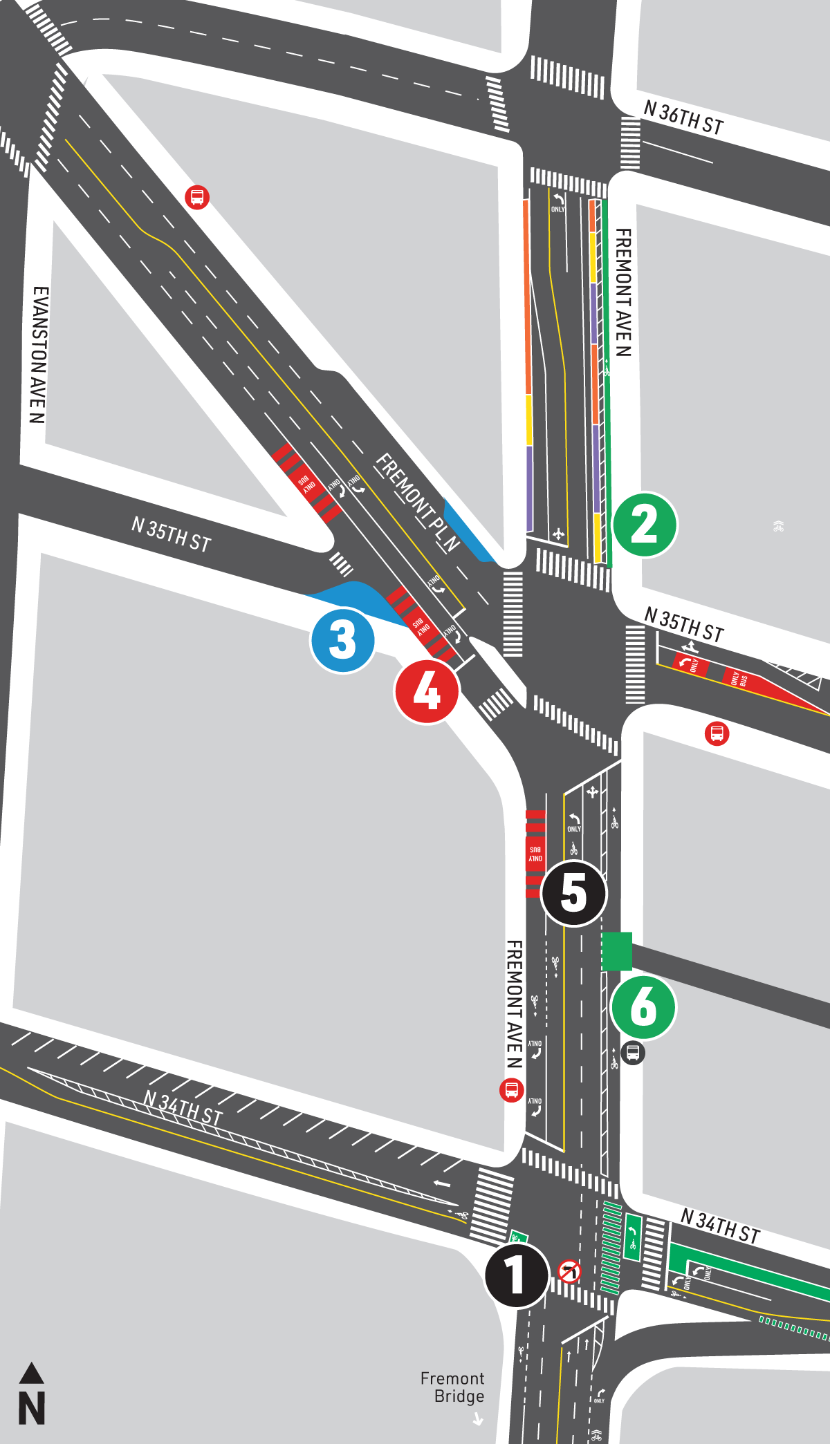
Click image to enlarge.
Legend:
1Restrict northbound left-turns, all day
2Northbound protected bike lane connection (removes ~5 parking spaces)
3Concrete sidewalk extension
4Southbound BAT lane
5Repaving and standardized lane widths
6Northbound protected bike lane connection with concrete barrier
Details about these improvements can be found below.
Fremont Ave N between N 34th St and N 35th St
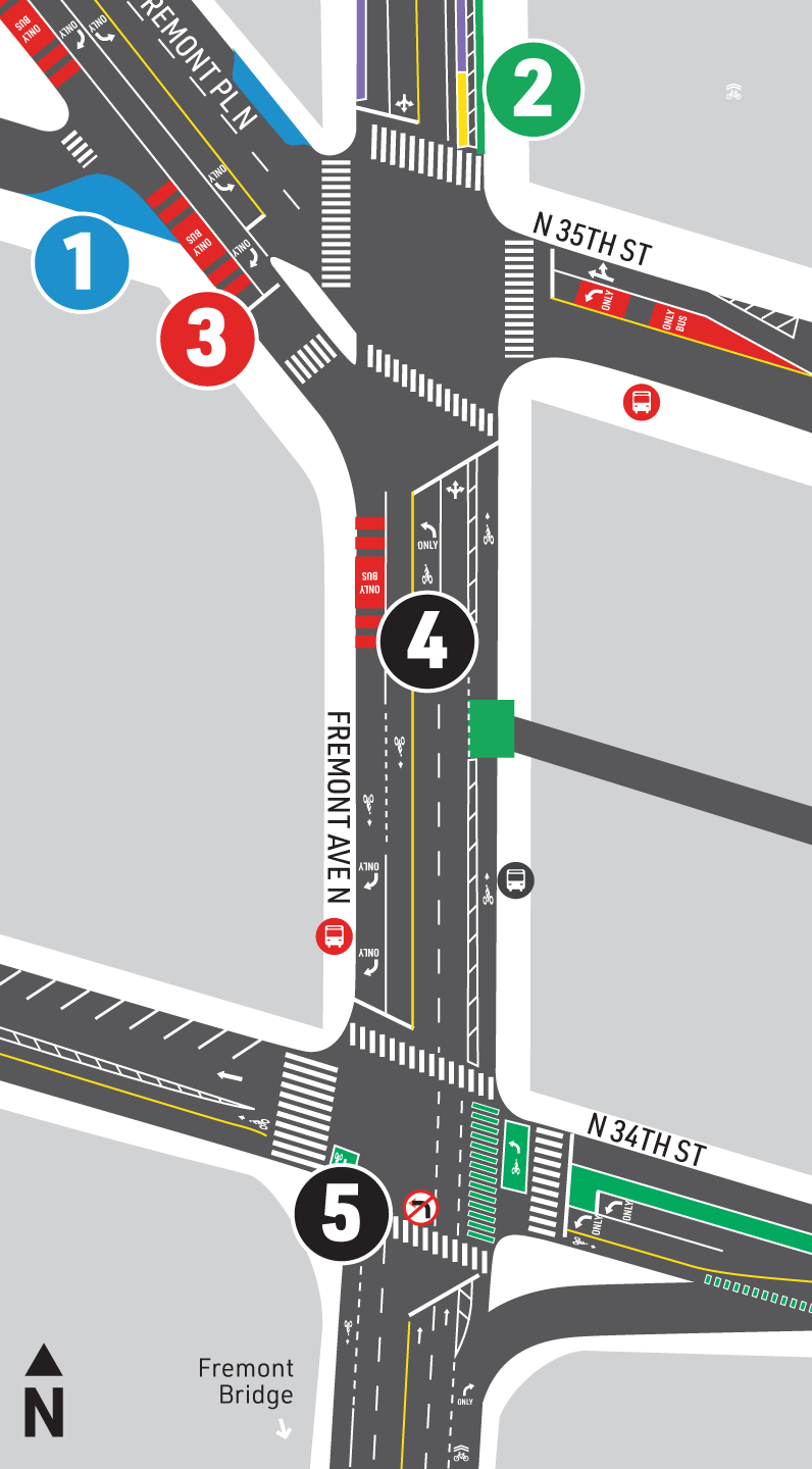
Plan view drawing of Fremont Ave N
Click image to enlarge.
Legend:
1Concrete sidewalk extension
2Northbound protected bike lane connection (removes ~4 parking spaces)
3Southbound BAT lane
4Repaving roadway
5Restrict northbound left-turns, all day
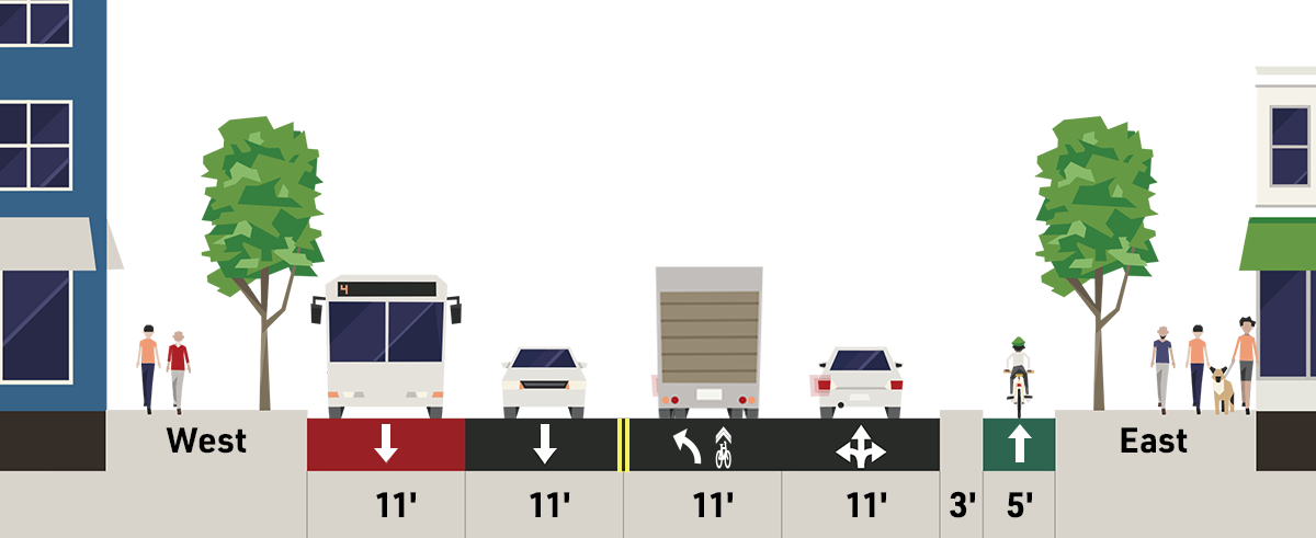
Cross-Section: Fremont Ave N between N 34th St and N 35th St
Click image to enlarge.
Fremont Ave N between N 34th St and N 35th St is a major business hub for the Fremont neighborhood. This area is connected to Seattle by a wide variety of transportation options, including protected bike lanes on N 34th St, the multimodal Burke-Gilman Trail, and a number of Metro routes. Currently, the area is served by Routes 40, 31, 32, and 62. Our updated design has reconfigured the travel lanes and bus stops to better meet our goals of improving reliability and travel times for Route 40 in this area, as well as increasing safety for all travelers.
Fremont Ave N between N 35th St and N 36th St
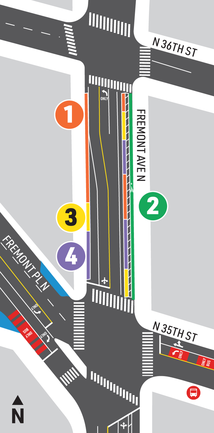
Plan view drawing of Fremont Ave N
Click image to enlarge.
Legend:
1No parking/stopping
2Protected bike lane
3Commercial loading
4Paid parking (2 hr)
Cross-Section: Fremont Ave N between N 35th St and N 36th St
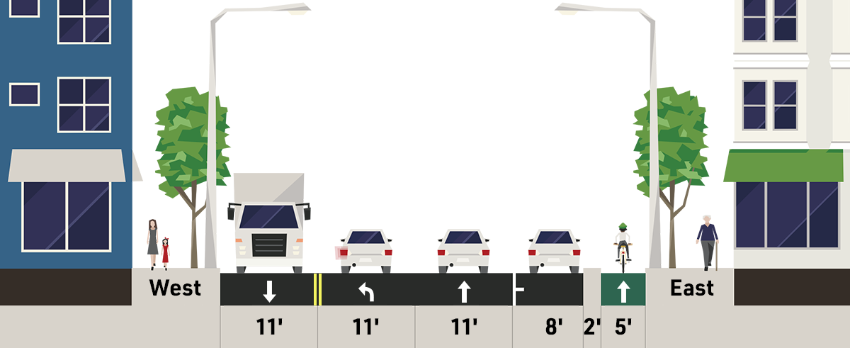
Click image to enlarge.
Fremont Ave N between N 35th St and N 36th St will be reconfigured to maintain parking and loading, as well as add a new protected bike lane.
N 36th St between Phinney Ave NW and Dayton Ave NW
Plan view drawing of N 36th St between Phinney Ave NW and Dayton Ave NW
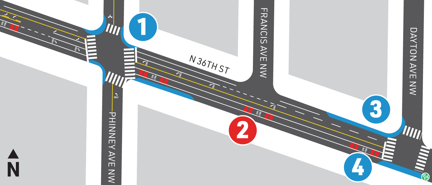
Click image to enlarge.
Legend:
1Concrete sidewalk extensions
2Southbound BAT lane
3Westbound bus bulb
4Concrete sidewalk extension, replace existing bike parking
Cross-Section: N 36th St between Phinney Ave NW and Dayton Ave NW
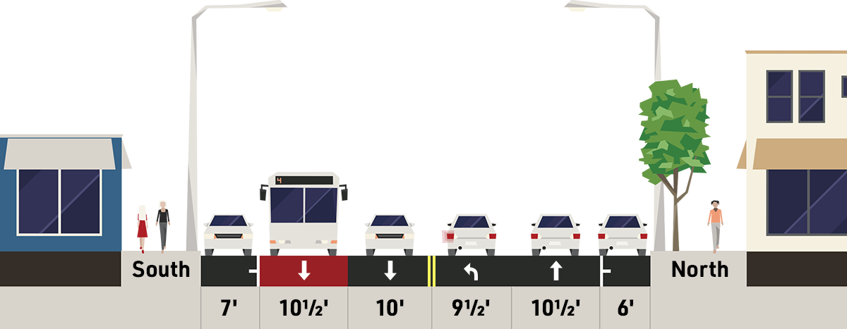
Click image to enlarge.
To improve transit travel times, a new southbound BAT lane is being installed on N 36th St. The street will also include a new center turn lane beginning at Phinney Ave NW.
N 36th St at 1st Ave NW
Plan view drawing of N 36th St and 1st Ave NW
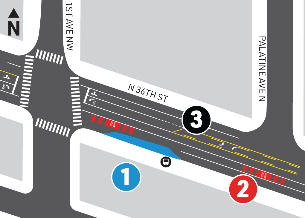
Click image to enlarge.
Legend:
1Eastbound bus bulb
2Southbound BAT lane
3Two-way center turn lane
Cross-Section: N 36th St and 1st Ave NW
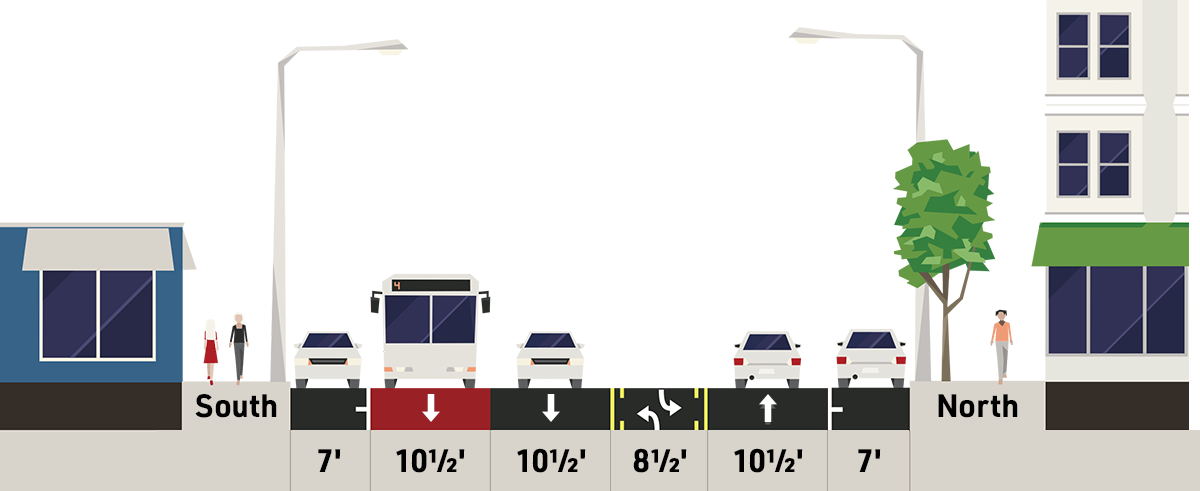
Click image to enlarge.
A new two-way center turn lane will be installed on the portion of N 36th St between Phinney Ave NW and 1st Ave NW.